
Tena Valley, a remote and charming natural place in the heart of the Pyrenees

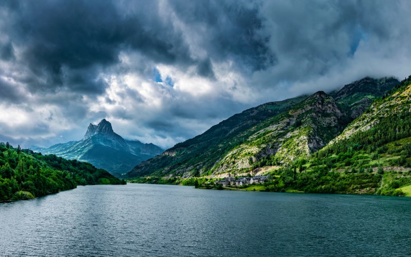
The Gállego River at its highest point gives rise to one of the most striking environments in the Aragonese Pyrenees. This is the Tena Valley, a well-defined territory that has functioned as a whole since the Middle Ages. Its villages are distributed between high mountains and low areas in which different reservoirs, such as Lanuza, are the protagonists of the scenery. A corner of Huesca shaped by tectonic, glacial and human action that allows you to enjoy hiking, culture and even skiing.

The three historic areas of the Tena Valley
Although today they use the municipal system present in most of Spain, in ancient times the Tena Valley was governed by different territorial units. Depopulation has always been a problem. For example, the Romans did not manage to completely colonise this remote environment, although they used it as a passing place. However, they did appreciate the mountainous thermal waters it possessed. The transition to the Middle Ages led to increased use of the area, especially after the Muslim invasion.
The remoteness of the Tena Valley made it easy for it to become a kind of a free trail, a Pyrenean pass frequented by those who wanted to go unnoticed. However, the villages were beginning to prosper. They were known as "vicos" at that time. These small towns evolved into districts that still retain a certain atmosphere of their own. They were placed under noble control by the King of Pamplona-Nájera Sancho the Great in the middle of the 11th century. This was a turbulent period, as the Kingdom of Aragon was established on the death of the Navarrese monarch. This entity would be the one to which the Tensinos settlements would end up being attached.
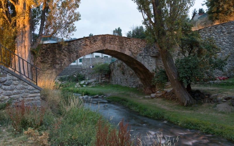
Representatives of the various vicos maintained close relations, which were vital in an agricultural territory dependent on pasture. In this way entities such as the "Hermandad del Tena" or the "Junta General de la Val de Tena" managed the place. In the end, three quiñones were formed, administrative units that survived until the municipality was established. The names of these divisions were Sallent, Panticosa and Partacua, the latter in the mountain range that gives its name. Romanesque churches are common and bridges of Roman origin abound.
Representatives of each quiñón met in the Junta General del Valle when there was something to discuss. The local economy was also sustained by royal privileges, which compensated for the isolation of the Tena Valley with, among other things, tax advantages. In force until 1836, the Ark of Privileges of the Tena Valley was kept as a treasure. This chest is kept in Panticosa and has three locks. Each key remained in the possession of one of the quiñones, thus ensuring the balance of power and the brotherhood between tensinos.
Santa Elena Gorge, the ancient entrance to the valley
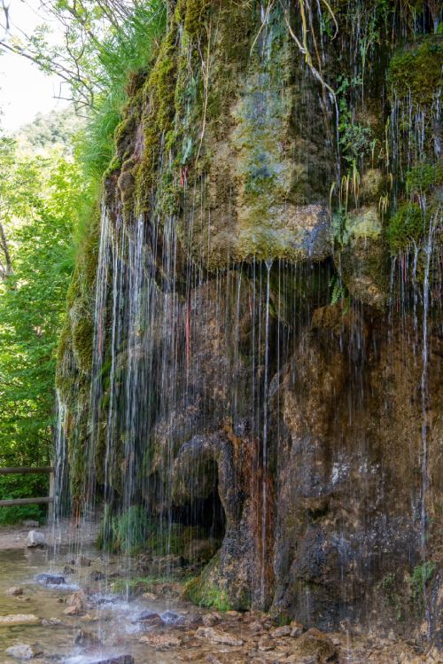
A strait separates the Tena Valley from the rest of the world to the south. The name is given by the patron saint of Tena, Santa Elena. Devotion to the mother of the emperor who definitively liberalised Christianity in Rome, Constantine I, goes back a long way. In fact, the folkloric tradition tells us that the saint was persecuted there by infidels. This legendary presence led to the appearance of the fountain of Santa Elena, with its irregular flow and waterfall shape. Depending on the locals, the fact that it is more or less loaded is linked to disastrous events. It is also said that the saint hid in a cave where a spider spun a protective web. Miraculous cavities are abundant in Spain, from the Barranco de La Hoz in Guadalajara to the Sacromonte in Granada.
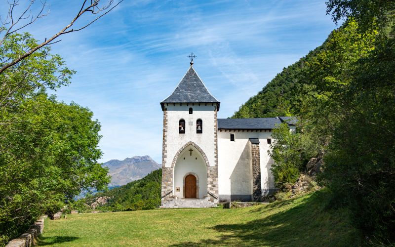
Turning to the historical side, the shrine has been much contested between Biescas and the Tena Valley itself. Located to the south, the village of Biescas is a crossroads before entering Tena territory. For this reason, although it is not part of it, it is very much associated with it. This is why it is usually included in the routes through the Tensino lands. Of Mozarabic origin, it attracted the attention of the Aragonese kings first and the Spanish later. Various reforms modified the exterior of the hermitage until it achieved the snowy finish that it has today. The figure of the saint, from the 17th century, or the entrance to the legendary cave are remarkable landmarks.
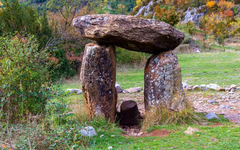
Near the gorge, one of the most notable in Huesca next to the Congost de Mont-Rebei, there is another place with sacred tints. This is the Santa Elena dolmen. Together with another nearby dolmen, barely 50 metres away, it makes up one of the most typical prints of the area. Both suffered serious damage during the Civil War, and are therefore worse preserved than similar megalithic formations such as Lácara or Guadalperal. The one on Santa Elena, which is some 5,000 years old, was rebuilt decades ago, while the second was rediscovered in 2018. In Tramacastilla de Tena, Piedrafita or Panticosa it is possible to find more tumuli, cromlech and dolmens. All of them make the Upper Gallego a megalithic reference point.
Finally, there is another element to be seen in the gorge. This is the fort that was responsible for defending it in the modern era. It dates from the time of Philip II, who wanted to protect the Portalet pass to France. Expanded during the Enlightenment, it was a bastion of incalculable strategic value. This is why it attracted the attention of the Gauls during the Napoleonic invasion. The fighting severely affected the structure, which had to be reconstructed in the middle of the 19th century. During the Civil War, it was the centre of a famous military action: the Tena Valley Stock Exchange. Caught up in a republican offensive at the end of 1937, fascist troops managed to resist until reinforcements arrived. In the end, the former stayed in Biescas and the latter in nearby Sabiñanigo.
Tena reservoirs to be discovered
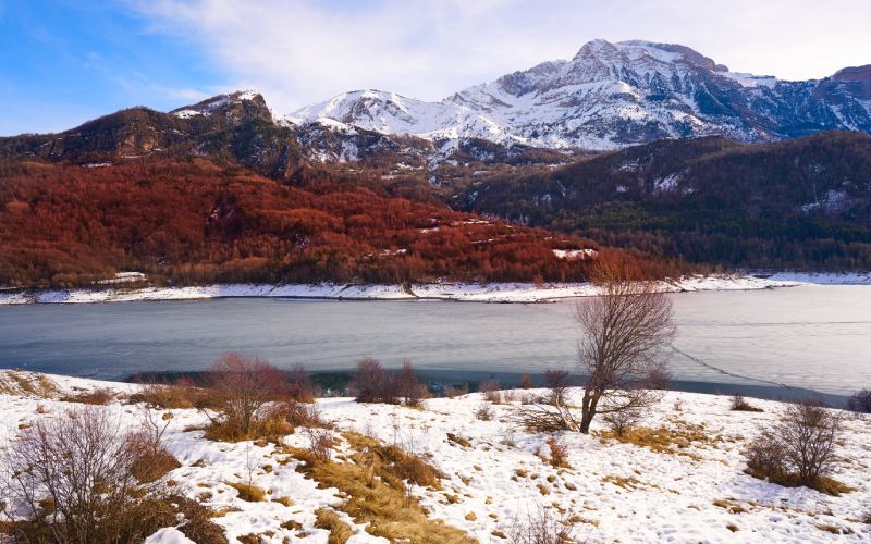
The 20th century was a time of change in the Tena Valley. Its tourist aspect is very recent and only came about after a long evolution. At first, the traditional rural and agricultural character prevailed. However, the Civil War meant that the region was quite affected. This was followed by reconstruction and finally the arrival of hydroelectric power. The 1970s saw the flooding of the Gállego River, as happened in places as far away as Gorg Blau in Mallorca or Peñarrubia in Malaga. The reservoirs of Lanuza and Bubal are the most notable result of this engineering interference. Reservoirs of Escarra and Tramacastilla should also be mentioned.
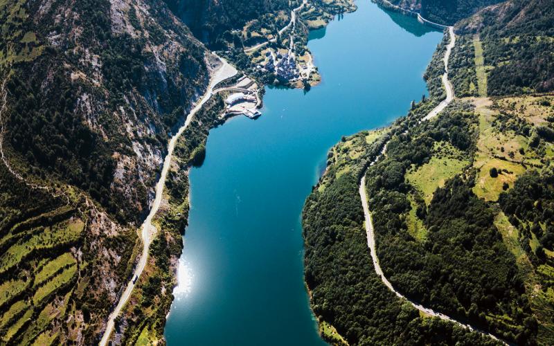
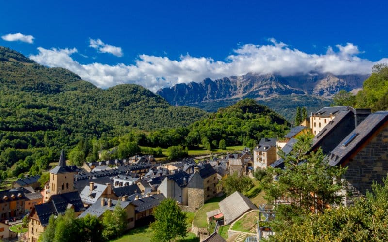
Some villages are almost drowned in the water. The one that gives its name to the first swamp was one of them. Some buildings were submerged. Almost depopulated, the neighbours finally managed to reclaim many of the surviving properties. Today it is a space trapped between the mountain and the reservoir, with a peculiar mountainous aesthetic. In the northern part there is another remarkable village, Sallent de Gállego. Cabeza de Quiñón, from it there are some of the best views of the valley and the artificial water body.
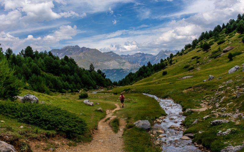
On the way to the Bubal reservoir you will find charming villages such as Escarilla, Sandinés and Tramacastilla on the western bank of the river, or Pueyo de Jaca and Panticosa on the eastern bank. From both sides they overlook the Piedrafita and Hoz de Jaca reservoirs. The name of the false lake comes from a village that is now abandoned. This toponymy also makes clear the influence of nearby Jaca. The course continues until it passes through the aforementioned Foz de Santa Elena. Throughout the area there are many different hiking routes that in the lower parts, formerly pastures, are as beautiful as they are easy to follow. Those in the next section, centred on the mountains, are harder.
Heights of the Tena Valley: Ibones and skiing
The fact that the Tena Valley is located between the massifs of the Pyrenees means that the mountain is a compulsory element to take into account during any visit. The connection with France was made through the Portalet d'Aneu. It does not reach 1,800 metres, unlike other local peaks. Balaitus or Picos del Infierno are examples of heights above 3,000 metres in the tense environment. For this reason, climbing is a very common tourist activity in the area. High altitude trekking is also common at lower altitudes.
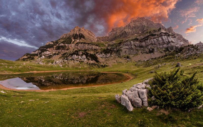
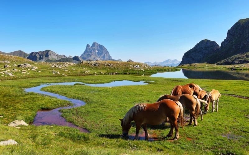
Ibones are glacial lakes that are scattered all over the Aragonese Pyrenees. The Tena Valley has some of the most famous ones in the mountain range. For example, the Piedrafita de Jaca. Under the watchful eye of Peña Telera, it can be reached by a simple walk from the village that gives it its name. With clear and cold water, it was part of La Partacua. The same is true of the Tramacastilla reservoir. On the opposite side of the Gállego, from Hoz de Jaca, it is possible to reach a spectacular couple: the lakes of Asnos and Sabocos. The clean and open landscape in which they are found is remarkable.
There are more notable lakes in the northern part of the Tena Valley. The one in Baños de Panticosa is a great attraction of this spa town. At the foot of the Picos de los Infiernos, it is part of the same village, connected to Panticosa by the Caldarés river. Not far away is the Ordicuso or Ardales, accessible by footpath. Meanwhile, from the Portalet it is relatively easy to reach the crystalline ibón de Espelunciecha. It is located to the west of the border crossing, as is Anayet.
Meanwhile, Formigal is the most famous name of this small region of Huesca. Not in vain, its ski slopes are classics of alpine sport. Pioneers in Spain, they have some of the most complicated stretches in the country. The network of routes also includes cross-country alternatives. Out of season, some of these trails become perfect places for active tourism. In any case, the routes for walking or cycling are endless and run through impressive natural surroundings.