Relocated villages that got a second life


Many Spanish villages have had to be moved from their original place, but that has only meant, in most cases, a new beginning. The construction of reservoirs, the possibility of even planning them or, in the worst case, a disaster forced the movement of entire populations. Sometimes just the fact of being without communication facilities, without light or resources made a whole locality change its location. At other times it was the government itself that decided to move them. A review that is also a clear example of resistance.
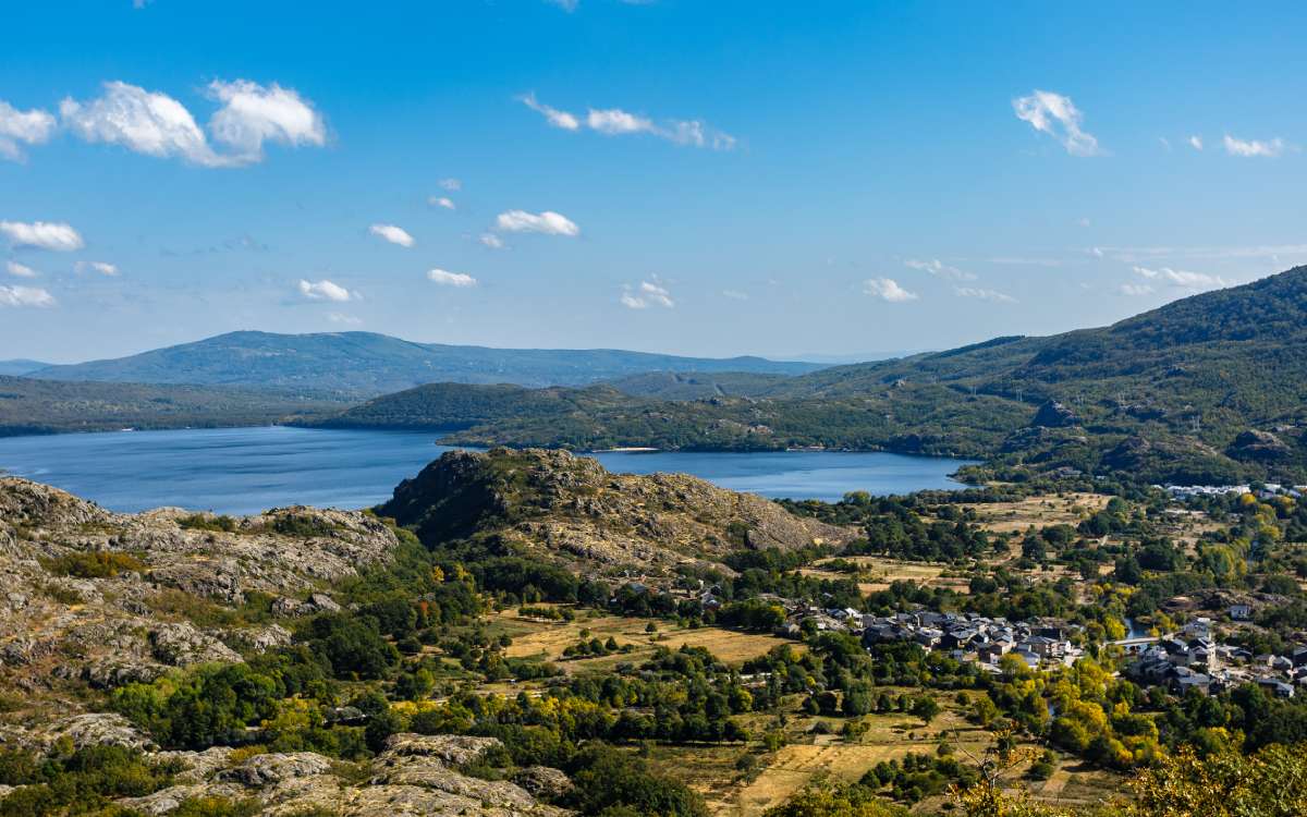
Ribadelago Viejo and Ribadelago Nuevo. | Shutterstock
The friars of the Order of Abbot John who fled the harassment of the Caliphate of Cordoba founded this small settlement in 920. In 1833 it became part of the province of Zamora, in Castile and Leon within the Sanabria Natural Park. On 9 January 1959 it became sadly famous when it was destroyed by the waters of the Vega de Tera dam, which killed 144 people. Today, interesting architectural elements are preserved, such as the town hall, the schools, part of the church and the houses.
The old village was not completely abandoned, although most of the population went to Ribadelago Nuevo. This town has very different characteristics from the original one, following more typical models of Andalusia or Extremadura. Something that is due to that it followed the precepts of the Plan Badajoz. The municipality of Galende, where it is, has several monuments that pay homage to the victims. Among the most recent is a sculpture commemorating the 50th anniversary of the tragedy.
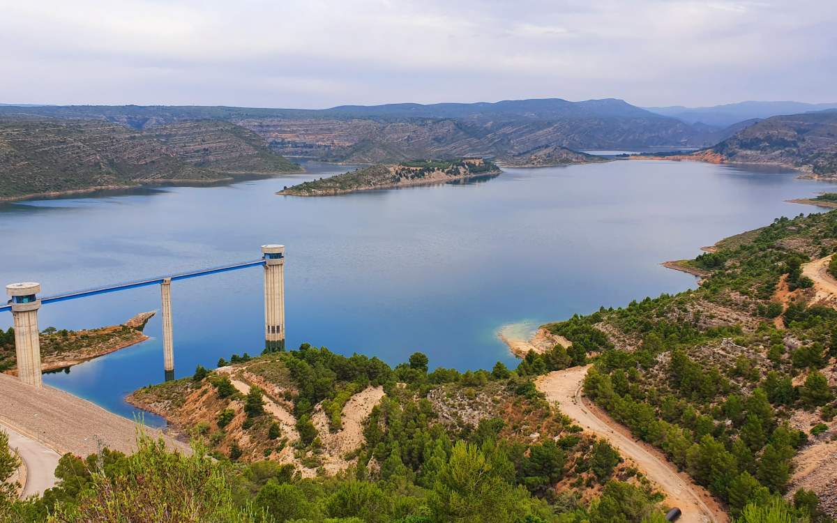
Tous swamp. | Shutterstock
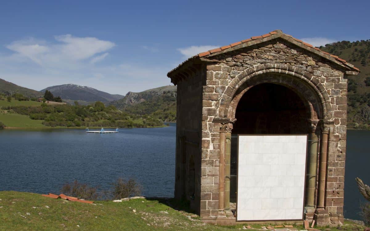
Both the old and the new village of Tous are located in the region of the Ribera Alta in the province of Valencia. In 1970 the construction of the reservoir to which it gives its name led to a forced move of the population originally settled on the banks of the river Jucar. The facade of the church could be preserved as it was moved, stone by stone in 1972 to its new location. There, 14 km from Alzira and 50 km from Valencia, it is possible to contemplate this magnificent monument from the beginning of the 18th century.
The rest of the ruins of the old village can be seen depending on the level of the reservoir. Its old streets, the houses, the Tower and the Castle are some of the surprises that the waters show to their visitors. The new enclave meant that it avoided to a great extent the greatest flood that has ever occurred in Spain, “la Pantanada” of 1982. An overflow of the dam forced two towns, Gavarda and Beneixida, to be moved. Alzira was greatly affected, as were the rest of the Ribera Alta and Baja. A dozen people died.
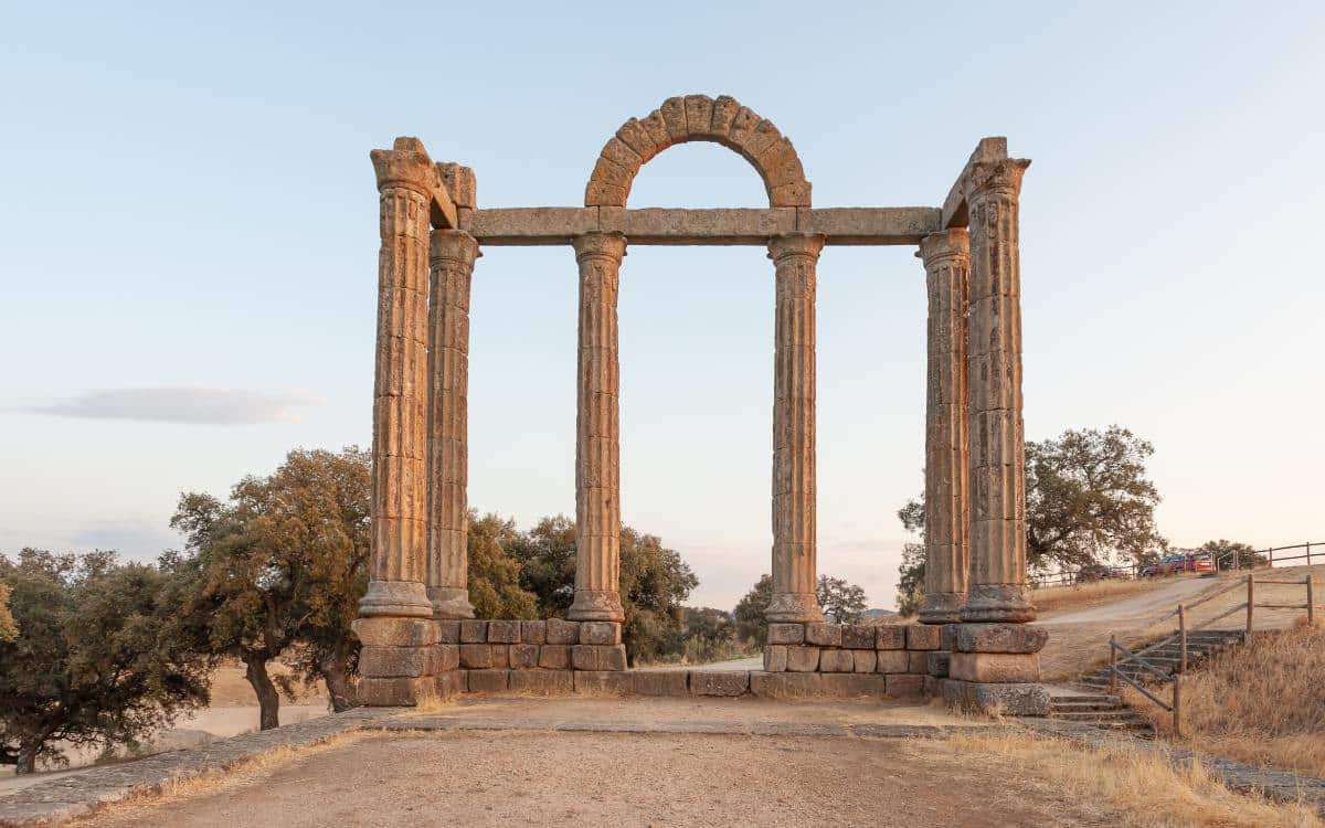
Los Mármoles in Valdecañas. | Shutterstock
The old Talavera was in the province of Caceres, situated on the remains of the ancient Roman city of Augustóbriga. The root “briga” indicated “fortified place”. It was flooded in the 60’s by the waters of the reservoir of Valdecañas. Its inhabitants were relocated not in one, but in several villages created for this purpose: Rosalejos, Tiétar del Caudillo, Santa María de las Lomas, Barquilla de Pinares and Pueblonuevo de Miramontes. All of them are part of the Campo Arañuelo region. For example, in the first one there is the Talavera jurisdictional roll.
The remains of the monumental complex of “Los Mármoles” are worth mentioning. Dated back to the 2nd century A.D., in 1963 they were moved stone by stone to their current location next to a reservoir bridge. On the whole it is possible to observe remains of stucco. According to the locals, the name came from the columns that had been decorated with glass. Next to it are the also Roman ruins nicknamed “The Temple”.

Valdecañas reservoir. | Wikimedia
In times of drought you can see the remains of the Church of the Santos Mártires. There are also vestiges of an ancient aqueduct or tarjea, of underground water pipes and baths. When the water drops sufficiently it is possible to appreciate the dolmen of Guadalperal, which has often been compared to that of Stonehenge. As a curiosity, in the town of Leganés it is possible to see a square dedicated to Talavera la Vieja and which includes one of the old Roman tombstones.
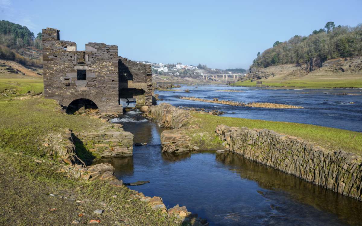
Ruins of the old Portomarín. | Shutterstock
Municipality of the province of Lugo in the Autonomous Community of Galicia. The old village was next to a Roman bridge over the river Miño and in 1962 with the construction of the Belesar reservoir it was swallowed up by its waters and moved to Monte do Cristo. In 1946 the original municipality was declared a Historic-Artistic Site. Buildings had to be reconstructed, such as the Church of San Juan, which was built in Romanesque style and was moved to its new location. When the riverbed runs low, the pilgrims of the French Way to Santiago, which passes through there, can observe the remains that appear with the descent of the river channel. The old pass over the Miño, various ruins and even the remains of the cemetery are visible.
Hermitage of Santa Catalina in Mansilla de la Sierra. | Shutterstock
Municipality located in the Alto Najerilla region in La Rioja. Bathed by the rivers Gatón, Najerilla and Cambrones, it was built entirely of stone and flint. In 1959 the new village was built, as the old one was totally covered by water due to the construction of the reservoir. In its surroundings it is possible to visit the Santa Catalina hermitage, saved by its altitude from the flood. It was built in the 12th century, with magnificent capitals and a semicircular apse that preserves a window with a Romanesque grille. Every year the waters expose the old town and it is possible to walk through its streets. In the new town, in the Church of La Concepción, there is a processional cross of Mozarabic tradition from the year 1109. This village was one of those that fell under the national hydrological plan of the time.

Ermitage of Sant Jordi in Fayón. | Wikimedia
Fayón or Foaió Viejo, in the Lower Aragon-Caspe region, is submerged under the waters of the Ribarroja reservoir. You can see the remains of the old houses, railway and cemetery. The oldest ones remind us of the boats that used to sail the Ebro loaded with lignite from the mines of Mequinenza, Almatret and Fayón on their way to the train station. The construction of the Ribarroja reservoir at the end of the 1960s forced its inhabitants to leave the village for the new town. The flooding of the village happened without previous notice and some neighbours returned to rescue the figures of the saints that had been left in the church.
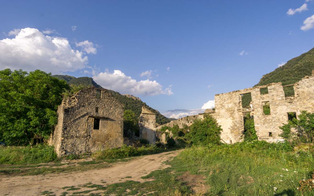
Ruins of Jánovas. | Shutterstock
Town in the province of Huesca. This population was expropriated by the construction of a swamp that was never really carried out. At the beginning of 1960, the expropriation of the properties began. Many residents led episodes of resistance, despite the fact that work on the reservoir had not even begun. The inhabitants were forced to leave the town, but none of them actually left their homes. The houses were demolished, the streets were empty and full of vegetation, which conveyed the “stubborn” character of the people.
In spite of the insistent pressures, several families remained in their homes in an unequal struggle. Barcelona, Zaragoza, Boltaña or Barbastro were some of the destinations of the former inhabitants of Jánovas. In spite of this, the Numantine spirit survived and recently different studies have been carried out for the reconstruction and repopulation of the town. Therefore, it can be considered that the town is in a kind of diaspora and they want the move to be temporary.
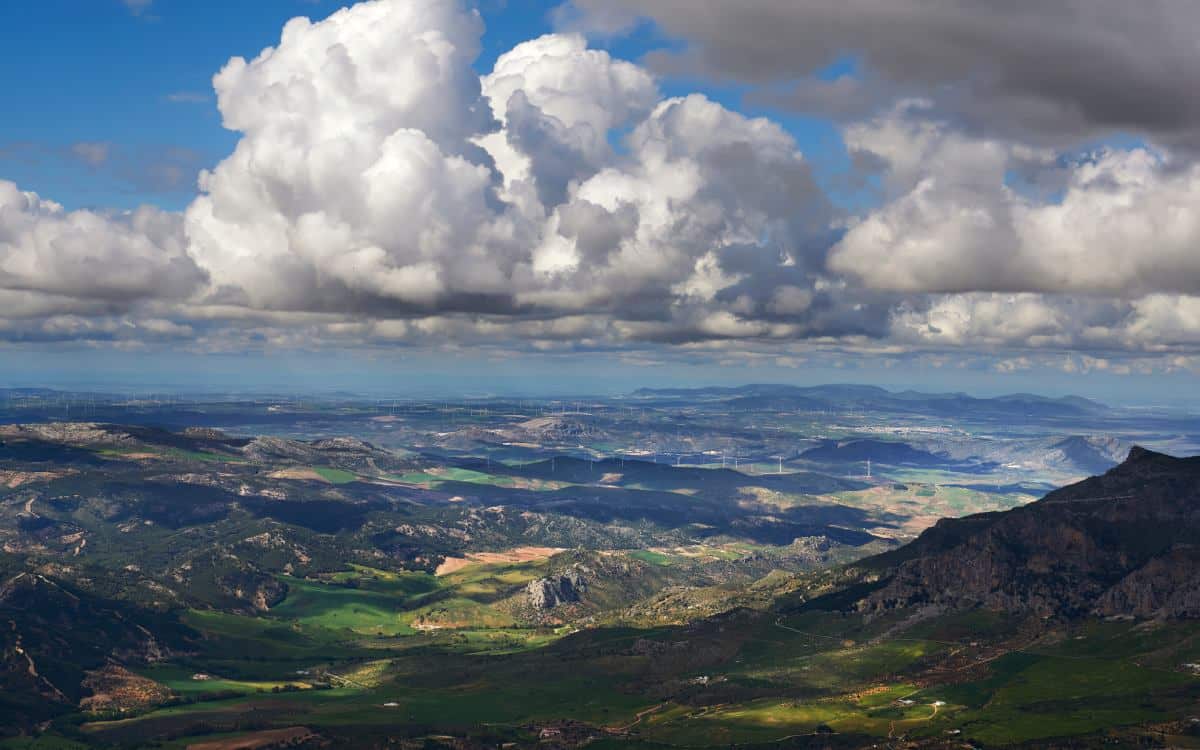
Guadalteba region, Málaga. | Shutterstock
In the province of Malaga, in the region of Guadalteba, was located the municipality of Peñarrubia. It was evicted in 1971 to build the Guadalteba and Guadalhorce reservoirs. For this reason its houses were demolished leaving only the Church, the school and the Civil Guard barracks.
The inhabitants moved to the district of Santa Rosalía in Málaga. There it can be considered that Peñarrubia is now. Nowadays, due to the drought, it is possible to see the remains of the Church and the cemetery of the village. Also of the necropolis of the Eras de Peñarrubia. It is a late Roman and Visigothic burial.
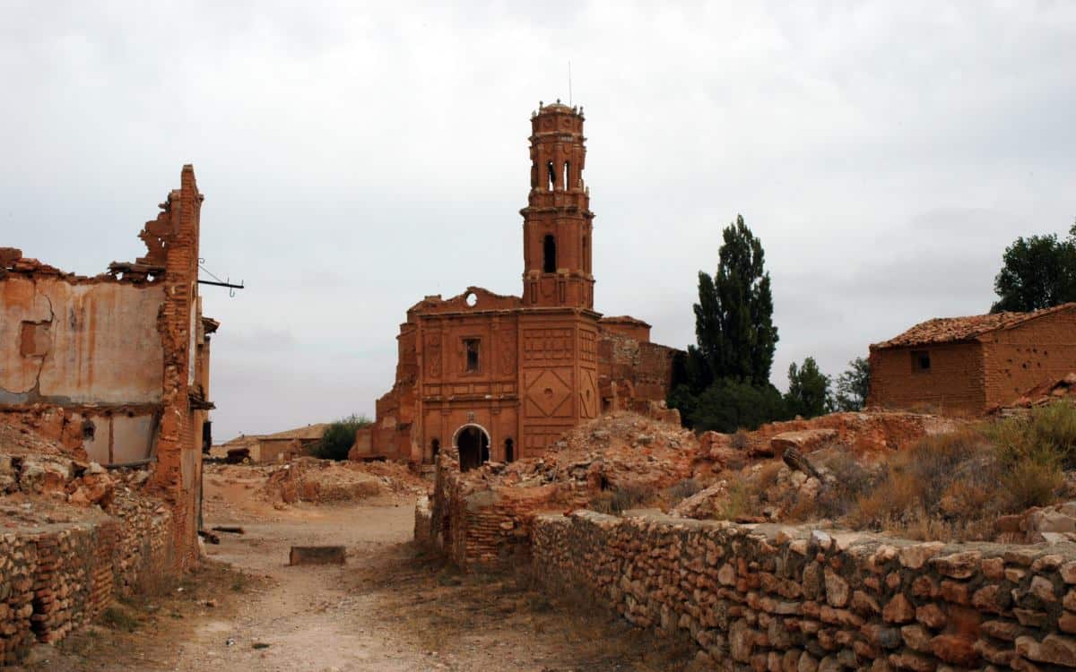
Ruins of Belchite. | Shutterstock
Located 49 km from Zaragoza, Belchite was the terrible scene of one of the most symbolic and bloody battles of the sad Spanish Civil War. During the battle, the village was almost totally destroyed and a new village was created right next door. This one was used as political propaganda by Franco’s regime as it did not enjoy any conservation measures. It was not until 2002 that it was declared a Site of Cultural Interest.
It is possible to visit the ruins of the old town both day and night. The church of San Martín de Tours with its 15th century tower or the Clock Tower are clear examples of the characteristic Mudejar style in Belchite. Its landscape has been chosen by many filmmakers as a setting for their films. For example, Guillermo del Toro used the place in El laberinto del Fauno.