Spain’s best motorcycle route and its stunning landscapes

It is said to be Spain’s best motorcycle road trip. However, it is also a wonderful proposition for any lover of slow ride, whether it be on two wheels or four, where the journey is the destination. The Silent Route, in the heart of Teruel province, invites one to drive unhurriedly, take pleasure in the landscapes opening up in front of one’s eyes and chance upon places of exceptional beauty.
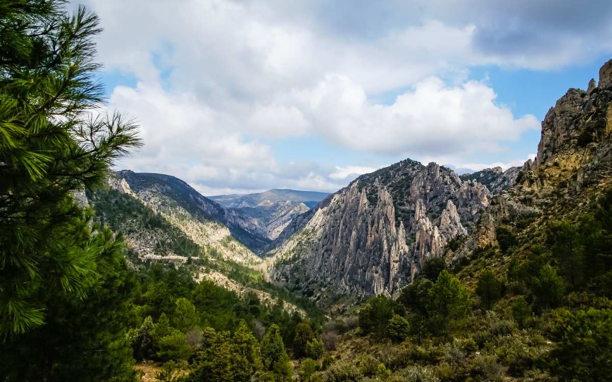
The Silent Route is a nearly 63-kilometre stretch of the A-1702, which crosses the Andorra-Sierra de Arcos and Maestrazgo regions. Here the road zigzags through hills and narrow gorges connecting sleepy towns with medieval aurae.
The Silent Route, from one end to the other – from Venta La Pintada to the Cuarto Pelado Pass – has more than 200 curves. The road’s design makes leisurely driving unavoidable. Nevertheless, the journey from beginning to end is all the more enjoyable knowing that behind every turn lies a surprise in the form of a picturesque scene of rural, and at times, wild beauty.
So forget about the accelerator and stop off at the scenic lookouts that dot the Silent Route. At the same time, do not neglect to stray from the main road now and then to reach some of the most incredible and lesser-known spots in the Teruel province. Our tour begins in the far north at Venta La Pintada.
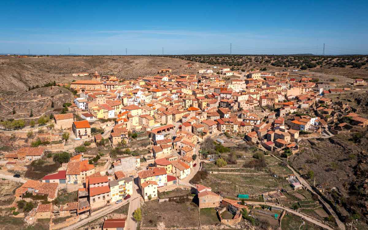
Aerial view of Ejulve. | Shutterstock
Perched on a small hill, Ejulve is a village of labyrinthine streets and traditional hallmarks including such gems as the Santa María la Mayor church. However, its greater treasures lie in its surroundings, like the Caleja del Huergo, a narrow gorge that offers a short but interesting hiking trail.
A few kilometres from Ejulve is the symbol of the Silent Route and one of the best scenic lookouts to be found along the route. It is the lookout at Alto Maestrazgo, easily recognisable for its enormous sculpture of an Iberian ibex, which has been christened the Silencioso. And this panorama is best viewed in silence for its picture-perfect vistas provide glimpses of the Coronas de Aliaga, the Alto de Pitarque and the limestone plateau of Cantavieja.
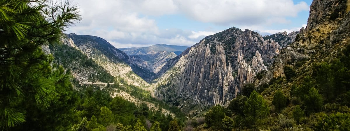
Órganos de Montoro. | Shutterstock
Descending from the Puerto de los Degollados and navigating the curves, one arrives at the next stop along the route, a true whim of nature. In fact, the Órganos de Montoro, named for its peculiar, pipe organ-like shape, is classified as a natural monument. They are an array of imposing needle-shaped limestone formations reaching 200 metres in height moulded by wind and water erosion.
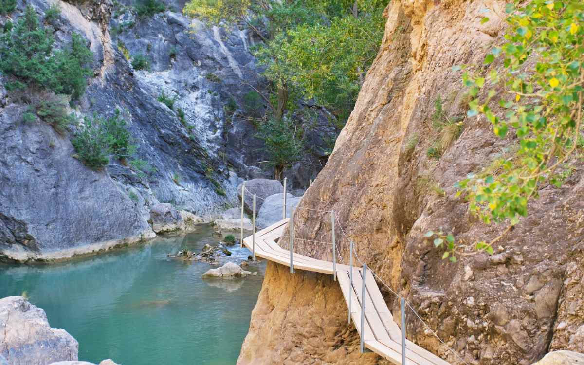
Wooden walkways at Valloré. | Shutterstock
Momentarily leaving the A-1702 and diverting to Montoro de Mezquita, one can visit the Gargantas de Valloré. Setting off from this small village is a walking trail leading to one of this region’s hidden treasures, the Estrecho de Valloré, a deep rock wall precipice of more than 100 metres, which can be traversed by a wooden walkway along the Guadalope River. Those who are more adventurous can continue along an ascending, more complicated section to reach the lookout, which offers one of the region’s most stunning views.
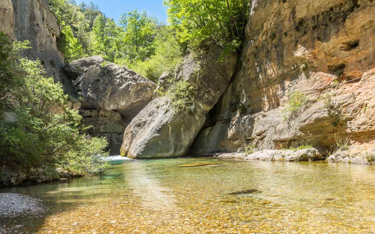
The source of the Pitarque River. | Shutterstock
This tiny village is tucked away among a wild natural landscape with crystal-clear waters, where the silence is broken only by a river flowing from the rock. The Nacimiento del Río Pitarque Natural Monument is not just a picture-postcard and a trekking route, but also home to the Griffon vulture and the Iberian ibex, emblem of the Silent Route.
However, it is worth taking the detour to Pitarque for another reason. The road linking the village with the A-1702 passes through a series of excavated rock tunnels, which deliver yet another iconic, picture-perfect scene of the Silent Route.
Villarluengo. | Shutterstock
Sitting high on a rock, Villarluengo juts out onto a landscape of hills and precipices through which the Cañada River flows. While it may be a scenic view from the road, it is also worth dedicating some time to stroll its cobblestone streets, admire its church and sixteenth-century town hall and to just simply reenergise before continuing the journey.
Another place of interest upon leaving the village is the Torre Gorgue. This small crenellated construction rising singularly from the landscape was built between the 14th and 15th centuries and once served as a watchtower.

Cañada de Benatanduz. | Wikimedia
The bedevilling nature of the Silent Route is, in part, due to the Cañada River. And the leg between Villarluengo and Cañada de Benatanduz is where it can be most appreciated. Here the road snakes through a deep canyon pierced by the river. Every curve allows one to view the river’s course and behold the flanking cliffs. The scenery is spectacular, but the meandering road on this particular leg requires special attention while motoring.
Once leaving Cañada de Benatanduz behind, to one side of the road one can observe a curious replica of an old bus that once transited the area. The original, green-painted vehicle had an alligator drawn on it, hence its nickname, the Caimán de las Montañas (The Mountain Alligator). It was also at the centre of a dark episode occurring on the 17th of February of 1948 when anti-Franco guerrillas attacked and burned it.
.jpg)
Cuarto Pelado. | Wikimedia
Here is the end of the Silent Route or perhaps the beginning if one decides to do it from south to north. Upon completing the road trip, this is the perfect place to take a break, stretch one’s legs and take the classic photo of the road sign indicating the route. And if one is still keen, the trip can be extended to Cantavieja, one of Aragon’s most beautiful villages.
You can also read this article in Spanish here.
.jpg)