The Natural Park of Peñas de Aya

 The Natural Park of Peñas de Aya (Aiako Harria) covers a total of 6,913 hectares of land in the easternmost part of Guipúzcoa, in the foothills of the Pyrenees, in part bordering Spain and France. It includes part of the municipalities of Irún, San Sebastián, Oiartzun, Rentería and Hernani.
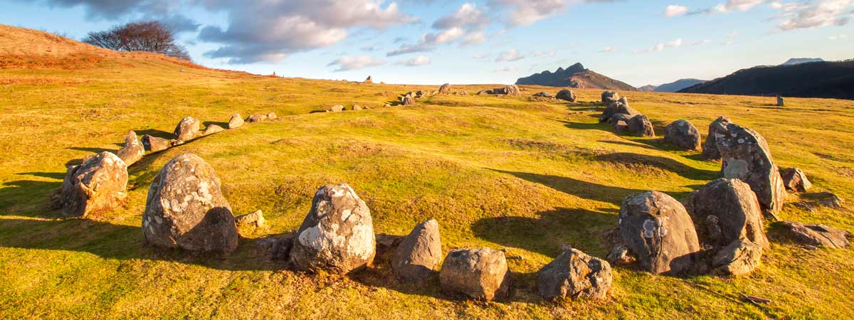
The territory of the park expands between the channels of the Bidasoa and Urumea rivers and it has its most visible face in the massif of Tres Coronas, – a great granitic elevation (the only one in the province) formed by the mountains Irumugarrieta, Txurrumurru and Erroilbide, which with its 837 meters of height also supposes its roof. The rest of Peñas de Aya has an irregular relief of great ecological value formed by deep valleys with a large number of ravines and waterfalls. Water is one of the main values
The predominant forest mass of the park of Peñas de Aya is composed of beeches or oaks. You can also find some endemisms such as soldanella villosa. Its skies are furrowed by birds such as the griffon vulture, the Egyptian vulture or the golden eagle; as to the fauna of Peñas de Aya, it includes wild boars, roe deer and foxes. The Endara River is a regular spawning place for salmon
Peñas de Aya is a usual place for active tourism enthusiasts, because it is a more than appropriate space to practice mountaineering, hiking or bicycle tours, thanks to the extensive network of signaled trails that crosses its lands. It also has an exceptional cultural value in the mines of Arditurri, that review a mining tradition that began to develop in Roman times.
Access:To enter the park of the Peñas de Aya, the most usual is by the GI-3454 road, which connects Irún with Oiartzun, or by the GI-3420, between Oiartzun and Lesaka. The park has several resting areas with their own parking.

In Hernani
Restaurante Iturralde
Restaurante Fagollaga
Restaurante Sidrería Iparragirre
Restaurante Sidrería Olaizola
In Irún
Restaurante Asador Trinkete Borda
Restaurante Amona kattalin
Restaurante Íñigo Lavado
Restaurante Danako
Restaurante Umeki
In Oiartzun
Resturante Zuberoa
Restaurante Matteo
Restaurante Joxixionia
Restaurante Intxixu
Restaurante Olaizola

In Hernani
Hotel Txinxua
Hostal Arrobi
Casa Rural Belazarte Etxea
In Irún
Hotel Alcázar
Hotel Atalaia
Hotel ETH
Hotel Urdanibia Park
Hotel Caserío Gure Ametsa
In Oiartzun
Hotel Lintzirin
Hotel Elizalde
Hotel Gurutze Berri
Hotel Usategieta
Casa Rural Peluaga Zahar
Camping Oliden

Horseriding Listorreta (Errenteria)
Paintball Jaizkiball(Errenteria)

Tourism Office in Oarsoaldea. Aialde Kalea 2, Oiartzun. Gipuzkoa. Spain. Telephone 943 494 521. GPS References aprox. 43º 17′ 56.09″ N – 1º 51′ 35.47″ W.
Tourism Office in Irún. Plaza Luis Mariano 3. Irun, Gipuzkoa. Spain. Telephone 943 020 732. GPS References aprox. 43º 20′ 24.5″ N
[image-carousel category=”peñas de aya parques”]