The route of Frente del Agua, where hiking meets history

Of all the hiking routes in the Community of Madrid, the route of Frente del Agua is perhaps the most surprising one. It is closely connected to the Spanish Civil War, and its paths allow us to approach history in a simple, inviting way. Hence, it is perfect for families. Moreover, the route will take us through both Republican and Francoist locations, as well as fortifications from the 20th century, and we will learn how this place came to play such an important role in the Spanish Civil War.

The reservoir of El Atazar in winter. | Shutterstock
The route departs from the interpretation center of Paredes de Buitrago, a former wash house. It traces a five-mile circle of forest tracks, pine forests and woodlands. Its paths are perfectly signaled with information panels and signs claiming “en busca de agua”; that is, “in search of water”. This is where the name of the route comes from, since water was a key element in this area during the Spanish Civil War.
We will first enter the area of the Republican side, with its half-buried bunkers. There are 26 pieces of defensive architecture throughout the route, including trenches, machine gun nests, and shelters. This front was in constant tension during the Spanish Civil War, and every trace of it perfectly illustrates that.
There are two main reasons why the route of Frente del Agua is perfect for the whole family. To start with, we have its low level of difficulty: apart from two moderate slopes, the route is fairly smooth. Secondly, we cannot forget its historical value, since the route of Frente del Agua provides a great way of teaching history to the younger family members, and thus avoid their repeating it, as they say.

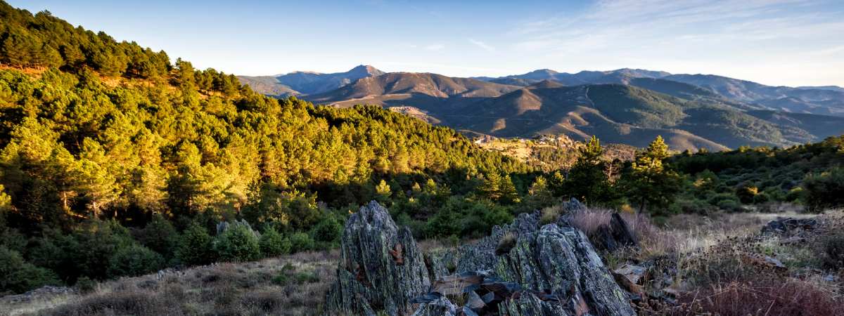
Madrid’s mountains hide fascinating spots we can see on the route of Frente del Agua. | Shutterstock
The most interesting aspect of this area in Madrid might be its two reservoirs, which supplied fresh water to the capital during the Spanish Civil War. Both the reservoir of El Villar and Puentes Viejas were key locations when it came to the city’s resistance, hence the Republican side made sure to keep them safe.
During the first days of the conflict, the Francoist troops, led by colonel García Escamez, took over the mountain pass of Somosierra, and they eventually reached Buitrago de Lozoya. They faced considerable resistance from the inhabitants of the town that were loyal to the Republic, and the Francoist troops were not able to advance. As a consequence, they had to change plans, and this challenge slowed down their victory over Madrid.
The fronts were already defined by the end of August, and they remained almost the same for the entire conflict. It was at that time that they started building trenches, parapets and shelters. In the following months, they kept reinforcing the line of defense, which was considerably long, and thus any minor mistake could be fatal.
Time has erased part of this chapter of Spain’s history, and yet it is still interesting to walk through the pine trees and the forests of this mountain range in the Community of Madrid, unveiling past wars that many seem to have forgotten. The information panels and guided tours let us explore the lives of the soldiers hiding up in the mountains, surrounded by both nature and battles. All in all, just as we said before, this is one of the most interesting routes in the Community of Madrid.
asasd