Three routes to explore the mountains of Sierra de Guadarrama in Madrid

The mountains of Sierra de Guadarrama spread over Segovia and the Community of Madrid. This range belongs to the Sistema Central, a system of mountain ranges crossing the centre of the Iberian Peninsula. It is home to more than 1000 plant species and at least 255 different animal species, such as mountain goats, Spanish imperial eagles and otters. The landscapes here present impressive geological formations, like the granitic range of La Pedriza or Peñalara, the highest peak of the mountain range of Madrid.
Sierra de Guadarrama has many other tourist attractions, and some of them are human-made, like the monastery of San Lorenzo de El Escorial, the monastery of Santa María de El Paular, the Royal Palace of La Granja, or the castle of Manzanares el Real. It makes sense that such a large area with so many interesting things to visit has several hiking routes. These are three lovely routes to explore the mountains of Sierra de Guadarrama in Madrid.

The peak of Peñalara. | Shutterstock
As we said before, Peñalara is one of the most remarkable peaks in the mountain range of Guadarrama, and it lies in the Community of Madrid. Hence, our first route had to lead us there. One of the main aspects that make Peñalara such a unique peak is its cirque glacier, one of the most important and best-preserved ones in Guadarrama. This area spreads from the mountain pass of Los Cotos to the saddle of Camino Nevero, its highest point being the peak of Peñalara, which stands next to four other peaks.
This mountain peak reaches a height of 2428 metres, and it marks the end of a trail that starts at the Centro de Visitantes de Peñalara, next to the mountain pass of Los Cotos. The trail going up to the peak spreads for 5 kilometres, with 600 vertical metres, which might be quite challenging for those who are not used to hiking. Besides, if you plan to go in winter, you should take into account that snow and ice might pose an extra challenge, and the adventure can even become dangerous if you are not an experienced hiker. Thus, we recommend doing it any other time of the year.
There are two other routes that share the same starting point, but end in different places. One of them is easy and accessible for everyone, and it ends in the lake called Grande, right in the cirque glacier of Peñalara. The other one will take us to the lake of Los Pájaros, and it is similar to the main route in terms of difficulty.

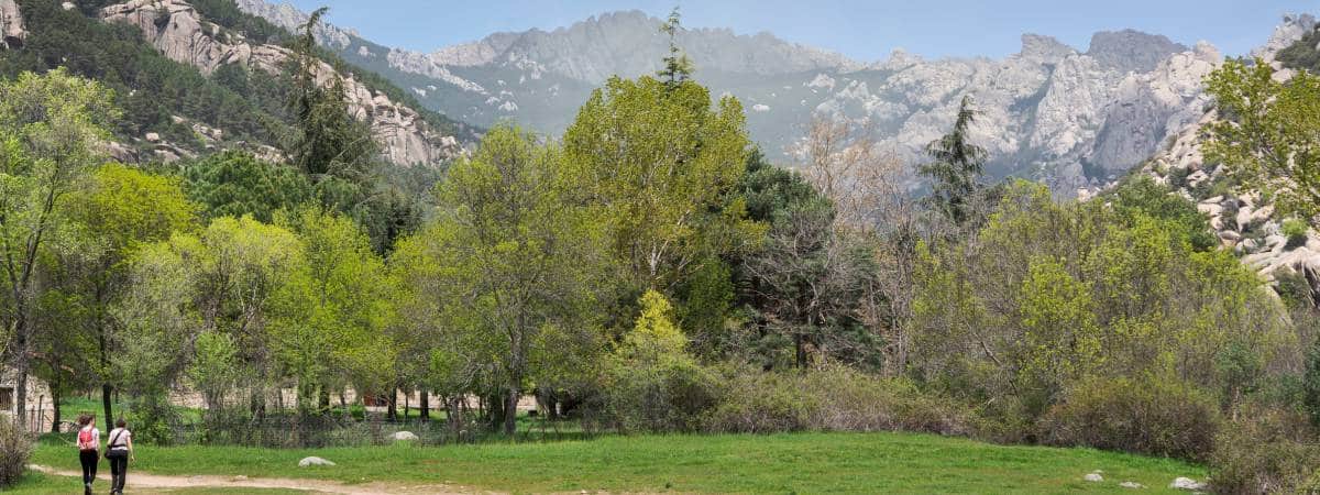
Sierra de Guadarrama, with Cancho de los Muertos at the background. | Shutterstock
The second route of Sierra de Guadarrama takes us to another popular spot in the mountain range: La Pedriza. It is a granitic range, and a geological feature of great value that lies at the most challenging climbing area in the world.
The trail of Cancho de los Muertos departs from the car park of Cantocochino, facing a wooden bridge that crosses over the river Manzanares. The trail goes on until it reaches the crossing of the saddle known as Cabrón. Only a few metres to the right, the traveller will be able to see the granitic range behind the name of the route: Cancho de los Muertos. They say that the bandits known as Pesetas executed their victims here during the 19th century, and hence the name, which could be translated as “Crag of the Death”.
After we leave Cancho de los Muertos Behind, back at the saddle of Cabrón, we will take a path to the right which will take us to the starting point: the car park of Cantocochino. This 5,6-metre circular route can be enjoyed by everyone, no matter your age, and it lasts for about two and a half hours. Manzanares El Real is only 15 minutes away by car, and it is perfect for ending up this lovely visit.

Beautiful views from the route of Cuerda Larga. | Shutterstock
The third route we suggest to explore the mountains of Guadarrama is the hardest one regarding its length, logistics, lack of signalisation and the difficult terrain. We are talking about the route of Cuerda Larga, an emblematic trail that not so many people have enjoyed due to the elements we just discussed.
This trail departs from the mountain pass of Navacerrada and it spreads until the pass of La Morcuera. It goes along some of the highest peaks of the Community of Madrid, crossing a rocky, uneven land, always at an altitude of 2000 metres.
The route spreads for about 20 kilometres, and these are the peaks it lets us admire: Bola del Mundo, Cerro de Valdemartín, Cabeza de Hierro Menor, and Cabeza de Hierro Mayor. The latter is the highest peak of the route and the second highest in Guadarrama. The route goes on until it reaches the hill of Pandasco, but we still have four peaks left to see: Navahondilla, Asómate de Hoyos, Bailanderos and La Najarra.
Those who have finished the route of Cuerda Larga assure that the effort is totally worth it, mostly thanks to the amazing panoramic views of the mountain range we can enjoy there. An average hiker can complete it in approximately nine hours, although the presence of snow might slow things down. In fact, we do not suggest choosing this route in winter if you do not have much hiking experience or own the right materials for the task, such as crampons. We should also go prepared in summer, with a good supply of water and sun cream, since there is almost nothing to protect us from the sun in Cuerda Larga.
We should also bear in mind that it is a long linear route. A way of addressing this could be by parking a car at the departing point and another one at the ending point of the route, or asking someone to come and pick us up once we finish. Another option is to split the route in two and spend the night on the mountains, sleeping out in the open. It is always possible not to finish the route and head back at any point we like. No matter how we do it, the route of Cuerda Larga provides a great opportunity to enjoy the natural landscape of the Community of Madrid, as well as a fascinating adventure we will never forget.
asasd