Peña Cabarga Natural Park


The Massif of Peña Cabarga covers a total area of 2,588 hectares containing many of the most interesting geological landscapes in Spain. In 1989, it was protected by the Government of Spain under the name Natural Park of the Massif of Peña Cabarga.
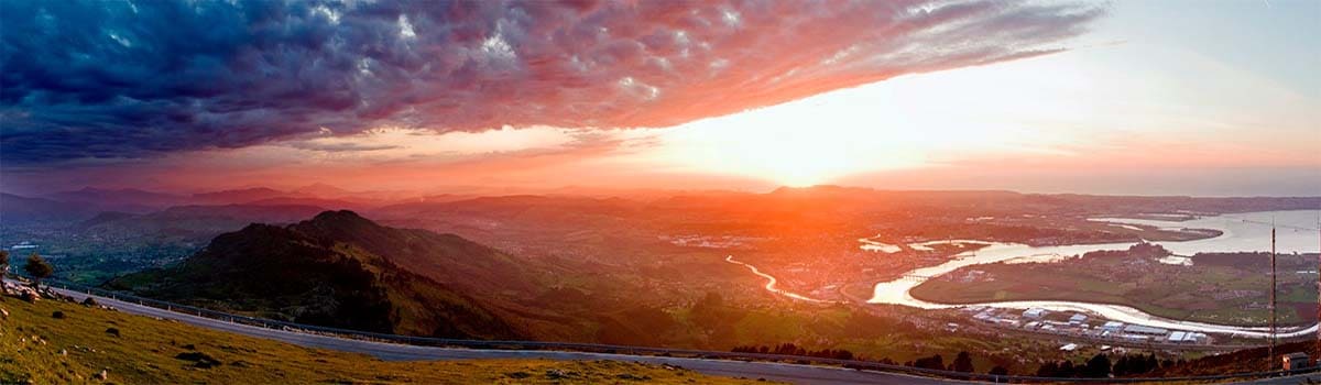
Peña Cabarga belongs to the Sierra de Gándara and its highest point is at 569 meters on Llen Peak. On its summit you’ll find the Indiano Monument and one of the best natural overlooks in the region, from which you can enjoy excellent views of the Bay of Santander, located to the north of the massif. The current terrain of Peña Cabarga has been shaped in part by the erosion of the limestone and by the iron extractions starting in the pre-Roman age in the form of open-cut mineral exploitations, no longer in use. The terrain of Peña Cabarga is marked by eye-catching karst formations which reach a high point at the karsts of Torres and Cabárceno; the latter is recognizable by its reddish color, an effect of the high iron oxide content of the clay that covers the rock.
Peña Cabarga also contains groundwater that rises to the surface on occasion through upwellings like La Covachota, where the Cubón River originates.
Vegetation: The massif’s most notable botanical formation is the coastal oak forest that stretches along its southern slope. At the lower heights, there are also formations of ash, oak, lime, elm, and hazel. The mammal population of Peña Cabarga is composed of foxes, weasels, shrews, and other small rodents. The most notable bird populations are Egyptian vultures, owls, little owls, grebes, and mallards.
Activities: Peña Cabarga is a center of hiking with several marked paths. The path that ascends to the summit of Llen Peak is among the most popular.
Entrances: This space is found nearby the city of Santander. Its main entrance is the CA-412 highway, which departs from the town of Heras and leads into the park, ascending up to its greatest heights.

In Cabárceno
Restaurante Los Elefantes
Restaurante Casa Venero
In Liérganes
Restaurante La Juguetería
Restaurante El Ojo del Abrego
Restaurante Bolo
Restaurante Bodegón Casa Daniel
In San Salvador
Restaurante Asador Cipri
In Santa María de Cayón
Restaurante La Granja
In Sobarzo
Restaurante La Yerbita
In Solares
Restaurante Casa Enrique
Restaurante Los Guardeses
Restaurante El Tejo
Restaurante La Estación

In Cabárceno
Posada Casa Venero
In Liérganes
Hotel Balneario de Liérganes
Hotel Miera
Hotel Casona El Arral
Posada Villa Esperanza
In Santa María de Cayón
Casa Rural La Balbina
In Sobarzo
Hotel Bajo el Arce
In Sobremazas
Casa Rural Las Encinas de Peña Cabarga
Casa Rural Los Acebos de Peña Cabarga
In Solares
Hotel Balneario de Solares
Hotel Los Guardeses
Hotel Casa Enrique
Apartamentos Villa Fresnedo
In Valdecilla
Posada El Hidalgo

Parque de la Naturaleza de Cabárceno (Obregón)
Turismo Activo Alto Miera (La Cavada)

Oficina de Turismo de Liérganes (Paseo del Hombre Pez, s/n. Liérganes. Teléfono: 942 528 543. Coordenadas GPS aprox. 43º 20′ 43.07″ N – 3º 44′ 37.32″ W)
Oficina de Turismo de Santa María de Cayón (Plaza de la Estación, s/n. Sarón. Teléfono: 942 517 724. Coordenadas GPS aprox. 43º 19′ 26.2″ N – 3º 51′ 12.45″ W)
[image-carousel category=”peña cabarga parques”]