Urkiola Natural Park

 Urkiola Natural Park occupies 5,768 hectares between the provinces of Vizcaya and Álava. It is a protected area of the Spanish Government since 1989 and includes the mountains of Duranguesado and the mountains of Aramontz and Aragio.
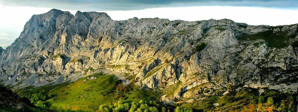
This area situated on the dividing line between Cantabrian and Mediterranean waters has its main axis in the port of Urkiola.
Its section is abrupt rather than low since its highest peak is located in the mountain of limestone Anboto at 1,337 meters height. This fact contribute to the appearance of diverse karstic landscapes throughout its geography.
The valleys of the lower areas are flanked by rough slopes full of ravines and cliffs that descend from the ridges of their highest heights. This place has several associated legends such as the one that places the home of the pre-Christian Basque goddess Mari in a cave located on top of the Anboto mountain. The human exploitation of these lands throughout history has focused on mining and agricultural activities.
Patrimonial highlights include the sanctuary of Urkiola or Santos Antonios, where San Antonio Abad and San Antonio de Padua were consecrated. As fun fact, Urkiola marks the geographical centre of the Basque Country and the line that divides the waters of the Cantabrian Sea and those of the Mediterranean passes through its roof.
The beech forest is the main forest in the Urkiola Natural Park, although there are several examples of holly oak or birch (urkia in Basque). In addition, the orchid limodorumabortivun, that it is not very frequent in this area, grows there. Livestock farming makes possible the presence of mares, sheep and cows in the meadows of Urkiola.
Urkiola Natural Park has many animal species such as the Falco peregrinus, the griffon vulture, Egyptian vulture, goshawk, sparrowhawk. As mammals, there are examples of wildcat, marten and polecat.

There are several hiking trails signposted. There are divided into two different parts. Those that goes through the Urkiola pass and those going along the Desfiladero de Atxarte.
The road B-623 (between Durango and Otxandio towards Vitoria-Gasteiz) cross the park from north to the south through the Urkiola pass.

Province of Biscay
In Abadiño – Abadiano
Bizkarra restaurant
Landajuela restaurant
Ostendi restaurant
Taberna Zarra restaurant
Santuario de Urkiola restaurant
In Durango
Barria restaurant
Kukutze restaurant
Gorrotxa restaurant
Txantonesa restaurant
Province of Álava
In Aramaio–Aramayona
Sidrería Iturrieta restaurant
Unzueta restaurant
Dukiena restaurant
Añai restaurant

Province of Biscay
In Abadiño – Adadiano
San Blas hotel
Zelaieta hotel
Santuario de Urkiola hotel
Buenos Aires holiday cottage
MuruetaBaseria holiday cottage
In Durango
Gran Durango hotel
Kurutziaga hotel
O Camiño hotel
Juego de Bolos hostal
Province of Álava
In Aramaio – Aramayona
Uxarte holiday cottage
Etxebarri holiday cottage
Muru holiday cottage

Active tourism and rural development Alluiz Natura (Abadiño)

Interpretation centre Toki – Alai. Puerto de Urkiola, s/n. Carretera BI-623. Phone: +34 946 814 155. GPS coordinates. 43º 6′ 3.29″ N – 2º 38′ 46.4″ W)